
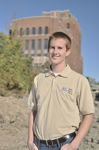
When Dan Gilles began his undergraduate work at the University of Iowa, he knew he wanted to pursue a civil engineering career path focused on water resources. Although he was aware of IIHR—Hydroscience and Engineering’s (IIHR) research impact, his interactions with it were limited.
That all changed in 2008. As Gilles was finishing his undergraduate degree, disaster struck the state in the form of a 500-year flood event, with the governor declaring 86 of Iowa’s 99 counties disaster areas. Iowans were thrown into crisis, as they scrambled to organize response and recovery efforts. In the immediate aftermath, there was widespread consensus that Iowans needed better tools and information to prepare for future extreme floods.
The event shifted both the trajectory of Dan Gilles’ career and transformed the focus of IIHR’s research initiatives to have a greater impact on the state of Iowa. IIHR’s expertise and legacy of excellence in solving water-related challenges were brought to the attention of Iowa’s Legislature, and thus, the Iowa Flood Center (IFC) was born. Since its establishment in 2009, the flood center has become a go-to resource for helping Iowans understand and reduce flood risks through monitoring stream conditions, reliable flood forecasting, watershed modeling, and flood mapping.
"My undergraduate studies gave me a great foundation, but joining IFC and being able to help communities and partners recover and prepare for the next flood was energizing,” Gilles said. “The attitude within IFC then was ‘All hands on deck!' and 'Let's get to work!"
Gilles embraced the opportunity to help shape the newly formed IFC, joining a team of researchers working on flood mapping across the state. The team was charged with remapping all 99 counties in Iowa for every Iowa stream draining more than one square mile. The maps were created using laser radar (LiDAR) data of Iowa’s river and stream network to develop computer-based simulations and delineate floodplains. They serve as a critical resource to help citizens, emergency managers, community leaders, and decision-makers identify and communicate Iowa’s flood hazards and support informed floodplain management decisions.
Gilles took on the task of flood mapping alongside his advisor, Nate Young, associate director of the IFC, and co-advisor Larry Weber, director of IIHR, creating one-dimensional (1D) and eventually two-dimensional (2D) models of Iowa’s river communities to visualize where and how rising river levels would impact the town. Gilles enjoyed the modeling work, describing it as “fun,” but he also recognized the real-world impacts of what he was creating.
“I hadn’t been exposed to making flood models and seeing how they perform in real life,” said Gilles. “You realize it’s a lot more important to calibrate and validate your models. There are real impacts and ramifications if not.”
Upon graduating in 2010, Gilles stayed at IIHR and became a water resource engineer. He continued working on the statewide floodplain mapping project and began leading IFC’s community-based flood inundation mapping efforts. These maps translate forecasted river stages for Iowa communities into high-resolution, interactive, scenario-based visualizations that support planning and decision making in advance of a flood. The utility of these map products has proven to be an invaluable resource to assist Iowa communities before, during, and after a flood event occurs.
“In short, we go to a lot of communities, make a model based on the bathymetry data — which is essentially a map of the underwater terrain — and other survey data we get, and then create a digital terrain model,” said Gilles. “We then use the digital terrain model to develop a hydraulic model of the community to run simulations and produce the digital maps of inundation that can be accessed by members of the community.”
That’s just one aspect of his job, though. Gilles and a few other researchers use that model to provide technical assistance to small communities for free — something that would cost tens of thousands of dollars if these communities had to hire an engineering firm. This modeling work allows them to suggest flood mitigation options that help communities prioritize goals and be more competitive for grant funding to implement flood resilience projects.
“For example, if there’s a creek that’s overtopping, we can do all sorts of 'what if' simulations and scenarios and find out what will actually move the needle in terms of flooding,” said Gilles.
In fact, Gilles and his modeling skills played an important role in a July 2025 flood event that impacted Riverdale, Iowa. Late on a Friday night, forecasts predicted a large volume of rain would cause the river to rise over the community's floodwall. Riverdale Mayor Anthony Heddlesten, an engineer himself, immediately jumped into action. Hoping to find reliable data to assist him in potential evacuation decision-making in the case of overtopping, he instead found that the local U.S. Geological Survey stream gage had been decommissioned, making a tough decision even more difficult to call. Heddlesten reached out to the IFC and eventually connected with Gilles and his colleagues. They stayed up late to perform additional analyses of the flood forecast and potential river levels. IFC’s modeling showed that the storm would not overtop the flood wall, preventing an unnecessary evacuation of more than 100 people.
Gilles's work has had a positive influence on both IIHR and the state of Iowa. He’s interacted with many local leaders, state officials, watershed partners, and water resource professionals, bringing with him goodwill and a can-do attitude.
“The attitude we have at the IFC is wherever we go, create goodwill,” Gilles remarked. “We want people to come away from working with us thinking we know what we’re talking about, we’re helpful, and friendly. You want to feel like you’ve made friends along the way.”
Throughout his work at IIHR and the IFC, Gilles has helped shape how Iowans understand and prepare for flooding. From modeling to community engagement, his efforts have provided vital tools and insights that support local decision-makers and protect lives and property across the state.