About the Network
The Iowa Flood Center’s network of hydrologic weather stations (hydrostations) helps researchers to better understand, monitor, and forecast hydrologic conditions across Iowa. The IFC is working toward a goal of deploying one hydrostation in every Iowa county to provide robust and uniform data in support of flood and drought monitoring and forecasting.
Data are collected in real time and updated every 15 minutes on the publicly available Iowa Flood Information System (IFIS) online web platform. IFIS provides enhanced flood monitoring and data visualizations communicated through an interactive, map-based flood forecast system. Tools available through IFIS help to lessen flood impacts by providing individuals, community leaders, agencies, and decision-makers with reliable information to reduce flood impacts and protect lives, property, and critical infrastructure.

Real-Time Data
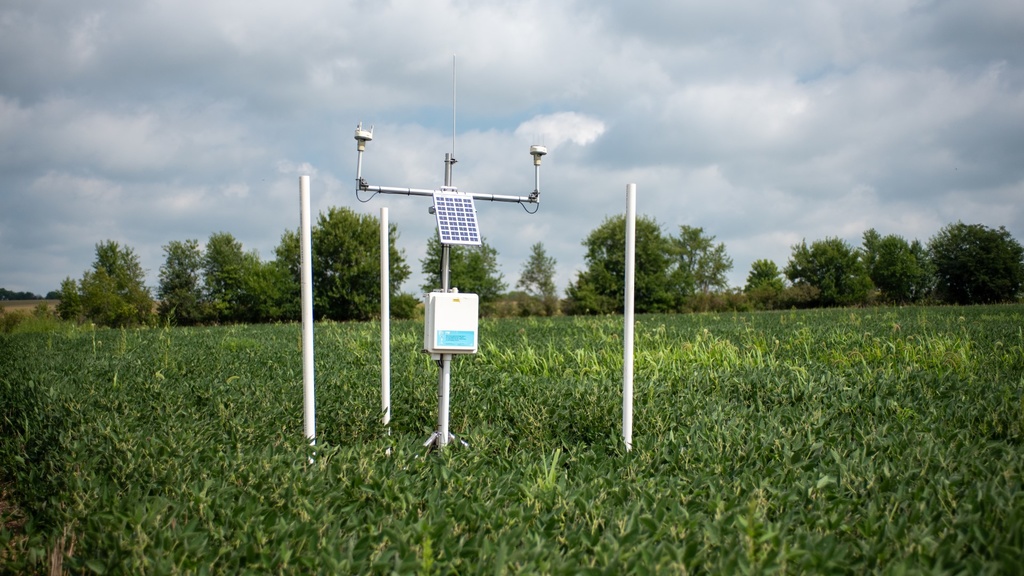
The central United States does not have a robust or uniform network of hydrologic weather stations to help researchers and local stakeholders monitor hydrologic conditions at the onset of flooding in real time. The IFC maintains a network of more than 50 hydrostations, which are low cost, low maintenance, and robust. They collect and transmit reliable data every few minutes (as programmed) to IFIS. Data collected inform the IFC’s forecast model and provide critical publicly accessible information to landowners, researchers, and agencies.
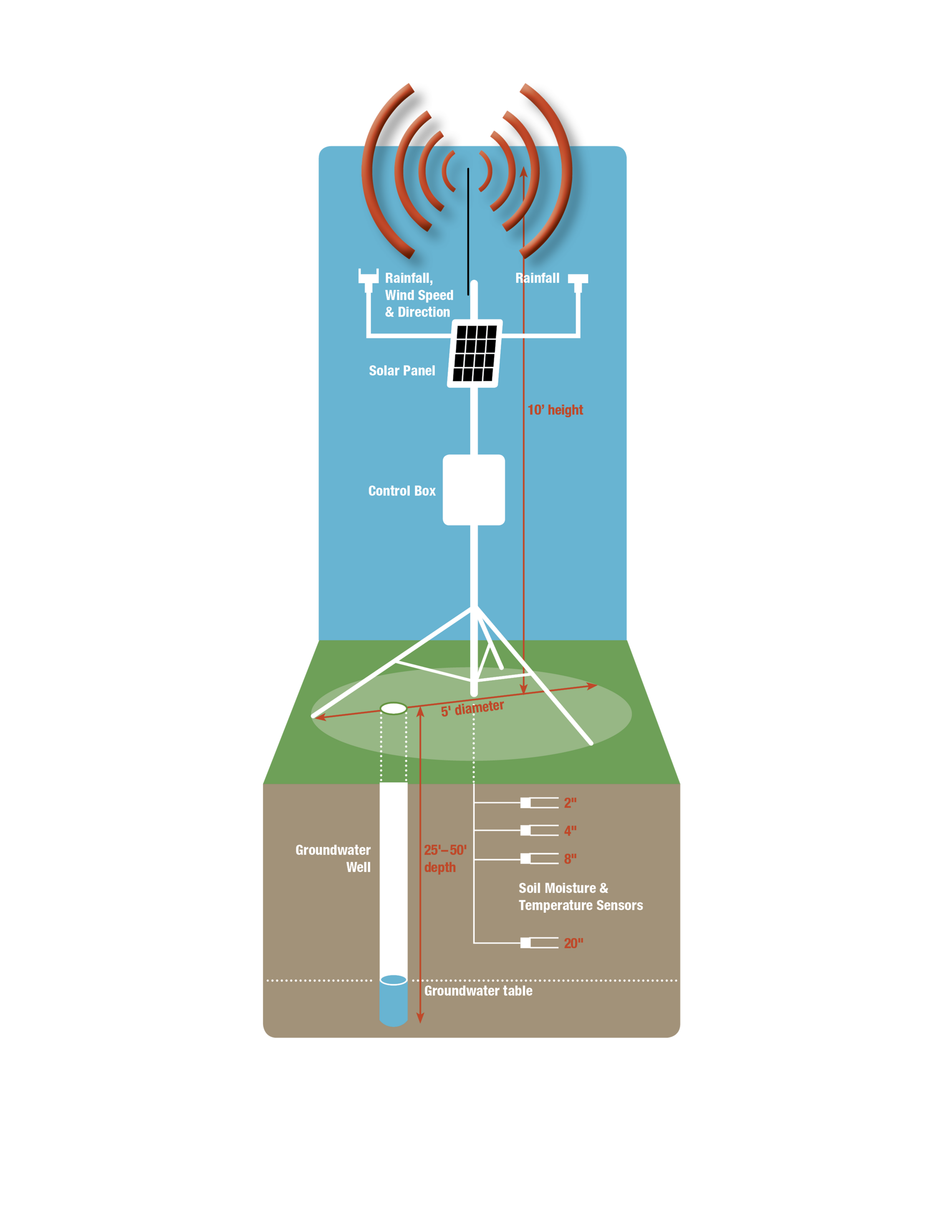
Data from the hydrostations help researchers monitor the short- and long-term impacts of climate change on water resources above and below ground. Parameters collected include:
- Wind Speed and Direction: Measures how fast the wind is blowing and the direction it is coming from, which helps understand weather patterns and their effects on the environment.
- Rainfall: Tracks the amount of rain that falls over a specific period, essential for monitoring water availability and predicting flooding or drought.
- Soil Moisture: Indicates how much water is present in the soil, which is critical for predicting flooding or drought conditions, and the soil’s ability to absorb water. This is also useful for plant health and agriculture operations. In the below monthly report, soil moisture is reported in volumetric water content (m3 /m3 ).
- Soil Temperature: Measures how warm or cold the soil — an indicator of the soil’s ability to infiltrate water, which depends on whether the soils are frozen or thawed. Also, temperature can affect plant growth, seed germination, and microbial activity.
- Shallow Groundwater Well: Monitors the water levels in shallow underground aquifers, providing insight into groundwater availability and its connection to surface water.
Data Resources
Access historical data for any of the IFC’s field monitoring equipment, including hydrostations and stream sensors.
Hydrostation Deployment Map
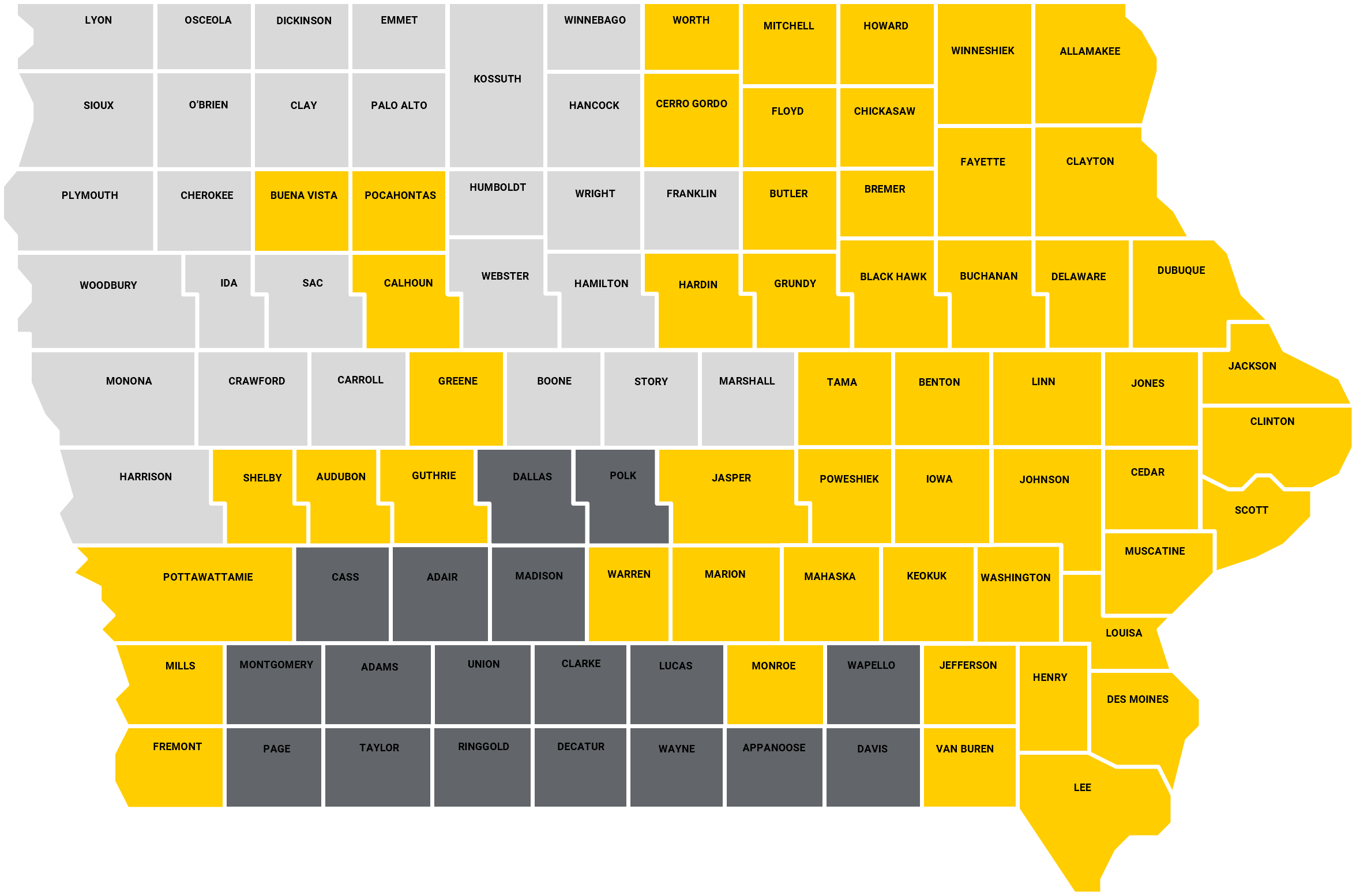
Figure 2: All the gold-colored counties have an operatational hydrostation. Through support from federal funding, eastern Iowa counties in Congressional Districts 1 and 2 received 31 new hydrostations in 2024. Dark gray counties in Congressional District 3 will potentially receive funding in FY26.
Featured Project