Iowa Flood Information System
The Iowa Flood Information System (IFIS) is a one-stop web platform to access community-based flood alerts and forecasts, flood maps, weather conditions, and other flood-related information and visualizations.
IFIS Key Resources
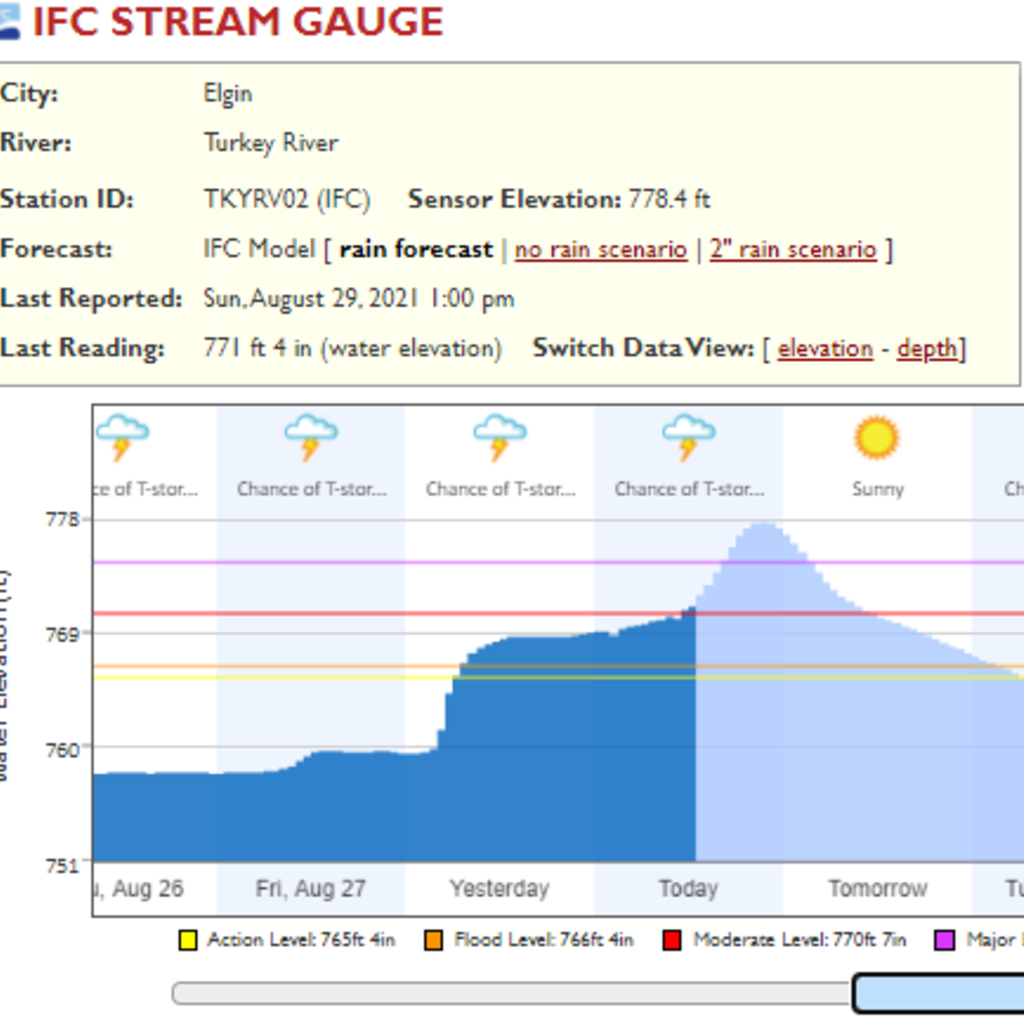
Stream Sensor Network
River levels updated every 15 minutes
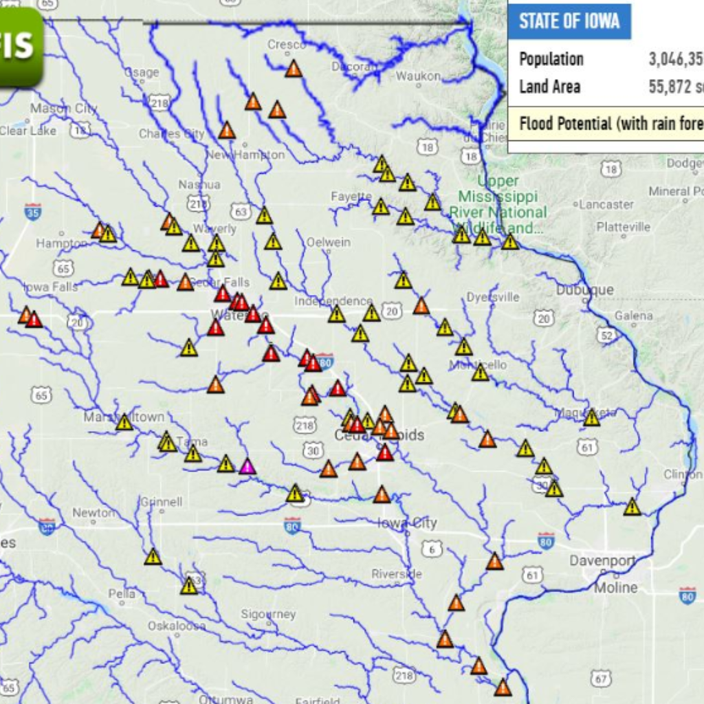
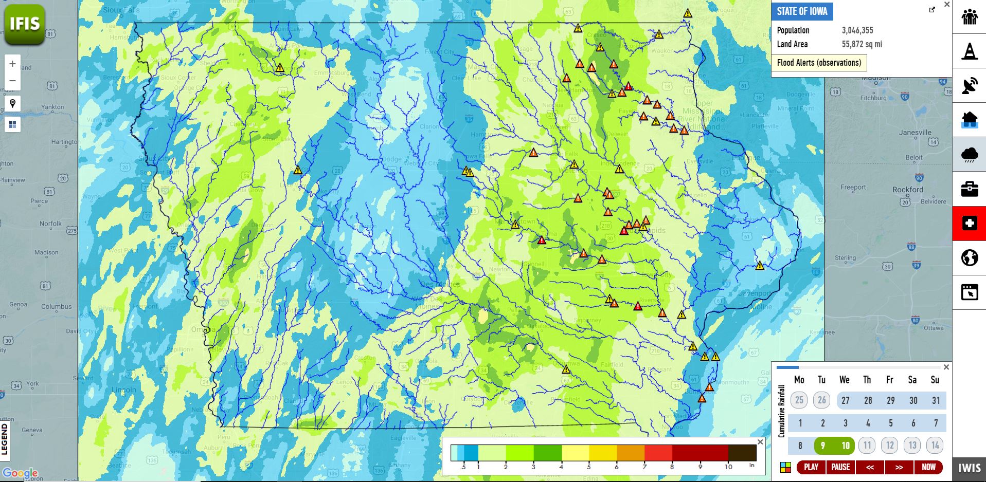
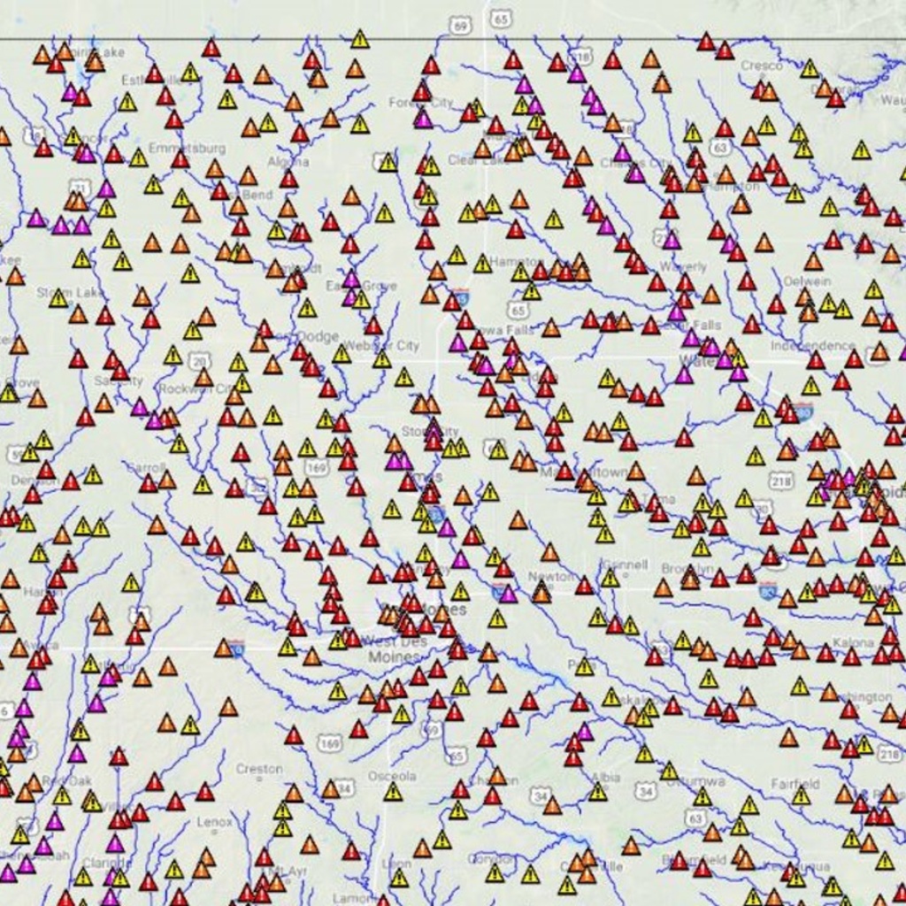
Flood Alerts
Flood alerts and forecasts enhance flood preparedness
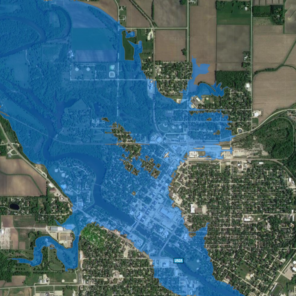
Flood Inundation Maps
Community-based flood maps show the extent and depth of predicted floodwaters
River Communities
Real-time flood information for more than 1,000 Iowa communities

About

Features

Tools

Data resources
Award Winning!
The Iowa Flood Information System is nationally recognized for its innovative approach to communicating flood risks and reducing flood impacts.
The IFIS structure allows other state and regional institutions to easily develop similar systems for transferring knowledge and disseminating flood-related data and information to the public. This publication provides an overview of the design and capabilities of the IFIS developed as a platform to provide one-stop access to flood-related information.


Contact IFIS
If you have questions related to current flooding, projects, or programs of the Iowa Flood Center, please contact: