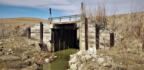
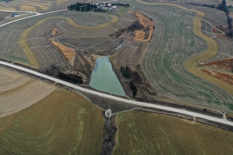
On-road structures (ORS) utilize existing road embankments as temporary dams, reducing the impact of flood events by holding back water for up to 48 hours during heavy rainfall.

In a new report sponsored by the Iowa Highway Research Board and submitted by research staff at the Iowa Flood Center, Iowa State University, and the Iowa Department of Natural Resources, suitable locations for potential ORS have been identified for every county throughout the state. The project identified approximately 250,000 potential ORS locations that provide optimal peak flow reduction benefits across Iowa. The information will support city and county engineers, agencies, local decision-makers, and watershed partners across the state with a reliable practice for consideration when planning to mitigate local flood risks.

“The on-road structures are a really effective way of working with the land to slow down and hold water back,” says Lee Bjerke, secondary roads research engineer at the Iowa County Engineers Association Service Bureau. “This project provides a roadmap for our state on where to invest in flood mitigation projects that can have substantial positive impacts on local communities.”
Northeast Iowa pioneered the concept of ORS and built five of the practices in the Otter Creek Watershed in Fayette County. An Iowa Flood Center (IFC) analysis shows these structures provide an estimated 30% reduction of peak flow during a 50-year rainfall event (6.5 inches in 24 hours) in some tributaries and have proven to be an effective flood mitigation practice.
"We’ve developed a statewide platform that visualizes potential locations for new on-road structures, offering an innovative alternative to conventional culverts that works with existing infrastructure,” said Larry Weber, interim IFC director. “The system quantifies the flood reduction benefits and estimates the flood storage potential of suitable new sites.”
The Iowa On-Road Structure Information Platform is available to the public and shows potential ORS locations and peak flow reductions broken down by county and subwatersheds, the area of land draining water. The user-friendly platform builds on the Iowa Flood Center’s expertise in developing similar online tools, including the popular Iowa Flood Information System. As part of the project, six smaller watersheds (highlighted in blue on the platform) show peak flow reductions and design information for constructing ORS practices. Design specifications are available for Winneshiek, Benton, Davis, Hancock, Crawford, and O’Brien counties.
The IFC will continue to monitor and analyze the ORS platform performance to make improvements, as necessary. The platform will help to inform future practice implementation and will encourage the adoption of ORS as an effective and reliable way to reduce flooding.
