Key Service Areas
The Iowa Flood Center works in cooperation with local, state, and federal partners to develop science-based approaches to effectively communicate and mitigate flood risks and help communities and individuals make informed flood-related decisions.
Cooperative Institute for Research to Operations in Hydrology
The Iowa Flood Center is a key partner in the Cooperative Institute for Research to Operations in Hydrology (CIROH), funded by the National Oceanic and Atmospheric Administration (NOAA) and led by the Alabama Water Institute at the University of Alabama. IFC researchers contribute their expertise in water resources prediction, hydrologic modeling and mapping, hydroinformatics (water information systems), flood monitoring, and outreach and education.

Flood Forecasting
Flood alerts and forecasts are available for more than 1,000 Iowa communities, helping all Iowans better plan and prepare in advance of a flood.
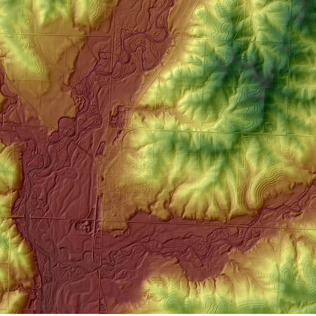
Flood Mapping
High-resolution statewide flood maps for every Iowa stream, along with scenario-based flood inundation maps, keep individuals and communities safe and informed — protecting lives, property, and critical infrastructure.
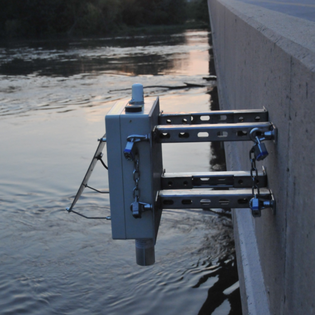
Flood Monitoring
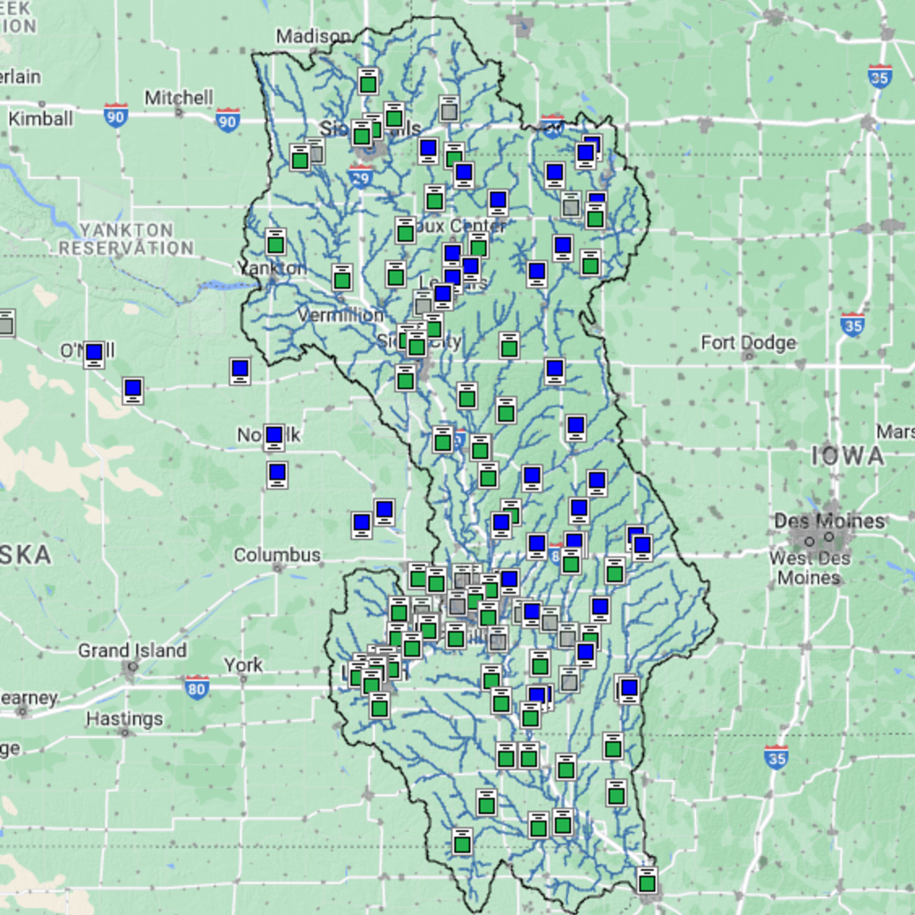
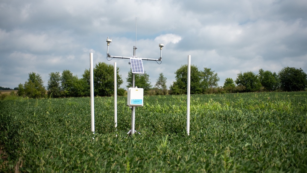
Nearly 300 stream-stage sensors designed, built, and deployed by IFC measure river levels every 15 minutes, improving flood monitoring and forecasting. Hydrologic weather stations improve flood and drought prediction capabilities.

Hydrologic Monitoring Network
The Iowa Flood Center’s network of hydrologic weather stations (hydrostations) helps to better understand, monitor, and forecast hydrologic conditions across Iowa. The IFC is working toward a goal of deploying one hydrostation in each county across the state to provide robust and uniform data to support flood and drought monitoring and forecasting.

Iowa Flood Information System
IFIS is a free, Google Maps-based web platform that communicates real-time information about stream levels, flood alerts and forecasts, and hydrologic conditions for the entire state of Iowa.
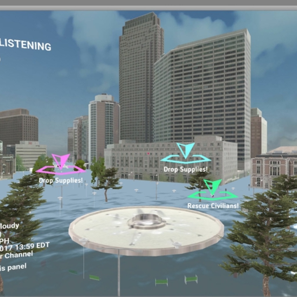
Missouri River Flood Information System
The Missouri River Flood Information System (MRFIS) provides comprehensive information on floods, streamflow and mitigation scenarios, and levee systems that can be easily modified to represent breaches.

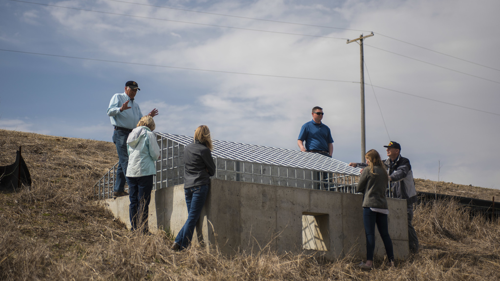
On-Road Structures
The Iowa On-Road Structures platform uses advanced hydrologic modeling and GIS-based analysis to quantify the flood reduction benefits of existing on-road structures (ORS) across Iowa. It also identifies suitable locations for the construction of new ORS. By providing data-driven insights, the platform equips planners and engineers to make informed decisions that promote sustainable water management and strengthen flood resilience while dedicating infrastructure investments for long-term environmental and community benefits.

Watershed Management
IFC staff and researchers provide leadership and technical expertise that supports collaborations with local, state, and federal partners to develop and implement watershed-based strategies to mitigate flood damage and increase resilience.
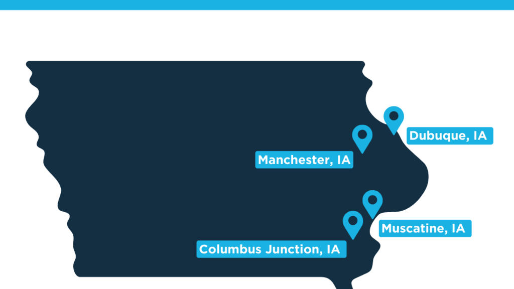
Project Spotlight
Iowa Flood Center receives $1M for Eastern Iowa
IFC Partners with American Flood Coalition on Flood Resilient Communities Cohort