Flood Maps for Iowans
Through a collaborative partnership between the Iowa Flood Center (IFC) and the Iowa Department of Natural Resources (DNR), interactive flood map products are available for all 99 counties in Iowa. The mapping effort benefitted from contributions from the U.S. Army Corps of Engineers, the Federal Emergency Management Agency, and the Iowa Natural Heritage Foundation.
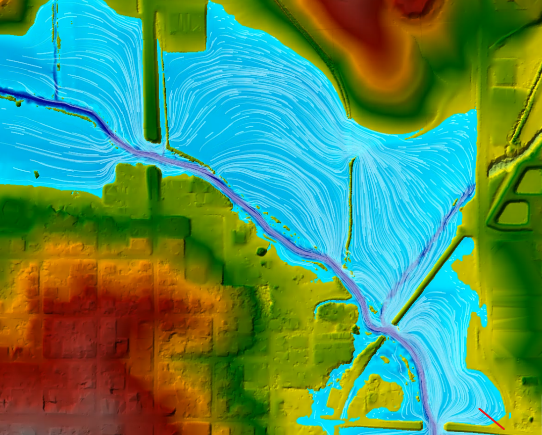
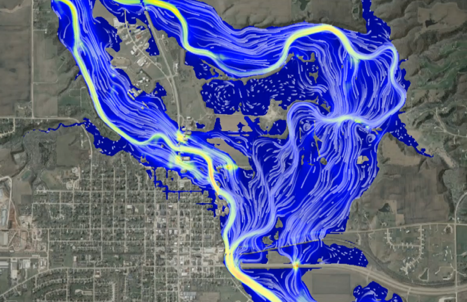
IFC researchers used laser radar (LiDAR) data provided by Iowa DNR to map all streams draining more than one square mile. This LiDAR remote-sensing technology allowed researchers to precisely map Iowa’s river and stream network, develop computer-based simulations, and delineate floodplains with reasonable accuracy. The maps are a critical resource to help citizens, emergency managers, community leaders, and decision-makers identify and communicate Iowa’s flood hazards and support informed floodplain management decisions. Nonregulatory flood maps showing the 2-, 5-, 10-, 25-, 50-, 100-, 200-, and 500-year floods are visually displayed on the Iowa Flood Information System.
Statewide Floodplain Mapping Project
Community Flood Inundation Maps
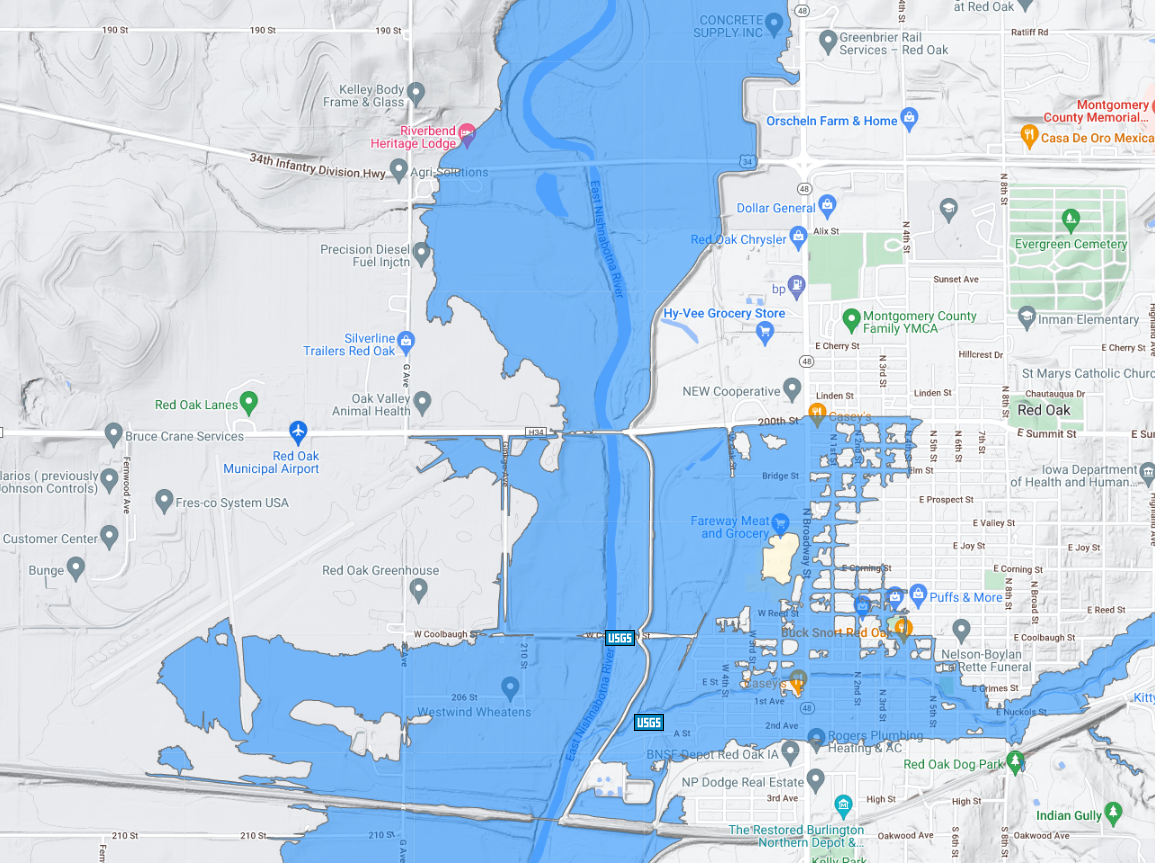
During the 2008 floods, communities lacked the context needed to relate the National Weather Service forecasted river stages to their property and to understand the extent and depth of predicted floodwaters. IFC has developed libraries of flood inundation maps for dozens of Iowa communities that translate forecasted river stages into high-resolution, interactive, scenario-based maps that are used for planning and decision-making in advance of a flood.
Inundation maps for dozens of Iowa communities are available on the Iowa Flood Information System. Maps are continually expanded for communities across Iowa.

Technical Assistance for Small Communities
The Iowa Flood Center provides free technical assistance to small communities, including:
- Hydraulic and hydrologic modeling
- Identification of suitable flood mitigation projects
- Conceptual designs for flood mitigation projects that can be leveraged for grant funding
- Assistance with FEMA mapping appeals and submittals

Technical Assistance Reports
Fredonia
Ida Grove
Columbus Junction
Plainfield
Featured Publication on Inundation Mapping
This publication highlights the Iowa Flood Center’s innovative flood mapping initiatives aimed at improving flood hazard awareness and resilience across the state. The IFC has developed a comprehensive floodplain mapping effort. The resulting maps and inundation libraries enhance Iowans’ ability to visualize and prepare for flooding. Recently, other states have turned to the IFC to improve their flood risk communication.