Articles from June 2020
Millions of homeowners who need flood insurance don’t know it — thanks to FEMA
Tuesday, June 30, 2020
It is FEMA’s job to warn homeowners about major flood risks, but its approach is notoriously limited. In Cook County alone, researchers found about six times as many properties in danger as FEMA estimated.
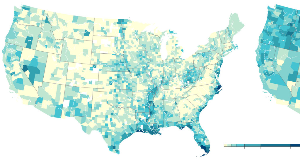
New data reveals hidden flood risk across America
Monday, June 29, 2020
Across much of the United States, the flood risk is far greater than government estimates show, new calculations suggest, exposing millions of people to a hidden threat — and one that will only grow as climate change worsens.

Sermet selected as a recipient for the Iowa Water Center’s Research Grant Competition
Monday, June 29, 2020
The Iowa Water Center (IWC) annually administers a statewide grant competition known as the IWC Graduate Student Research Competition.
Iowa Flood Center releases new community flood prediction maps
Wednesday, June 24, 2020
Researchers with the Iowa Flood Center at the University of Iowa are releasing new community flood maps following recent rain across the state.

Over 30 new Iowa Flood Center stream sensors installed
Friday, June 19, 2020
The Iowa Flood Center (IFC) at the University of Iowa has installed over 30 new stream sensors this spring to help communities be better prepared when water levels begin to rise. The new stream sensors help fill identified flood monitoring and forecasting gaps, providing river level information for informed decision making.
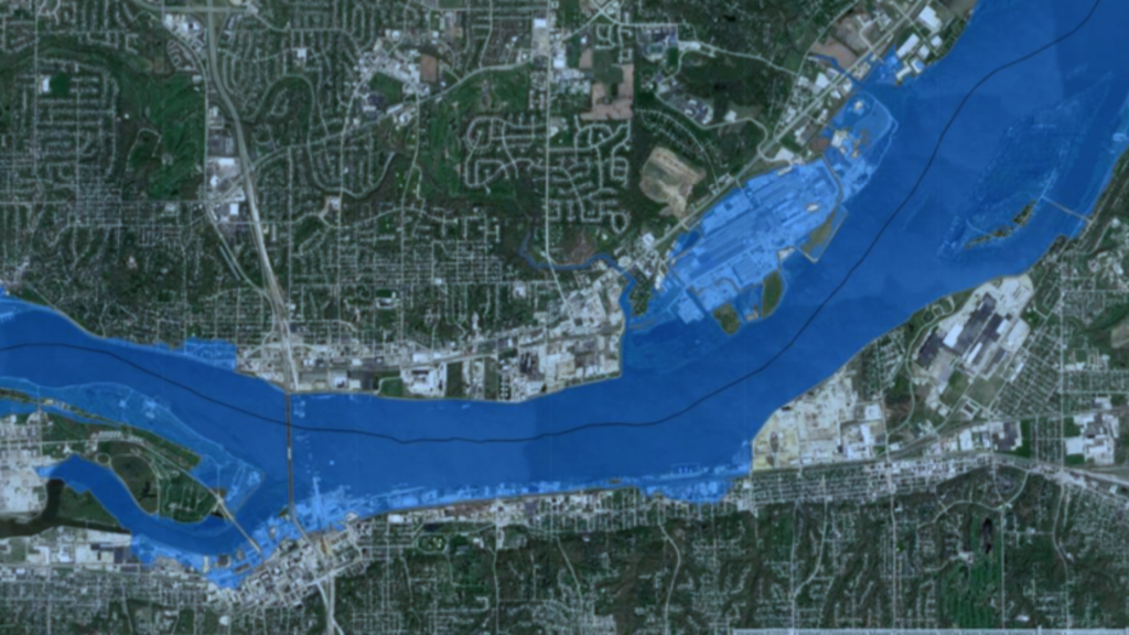
New Mississippi River flood maps
Tuesday, June 9, 2020
The Iowa Flood Center (IFC) at the University of Iowa has recently developed scenario-based flood inundation maps for the Mississippi River, stretching from Lock and Dam No. 11 in Dubuque to Lock and Dam No. 19 in Keokuk.